- Navigate with our best offshore and inland lake coverage for your Garmin chartplotter
- Customize your view with various chart layers and overlay combinations
- Select up to 10 color-shaded target depth ranges to scope out the best fishing spots
- Auto Guidance technology lets you navigate with suggested dock-to-dock routings
- Featuring vibrant colors, a streamlined interface and combined coastal/inland content with a popular navionics style color palette
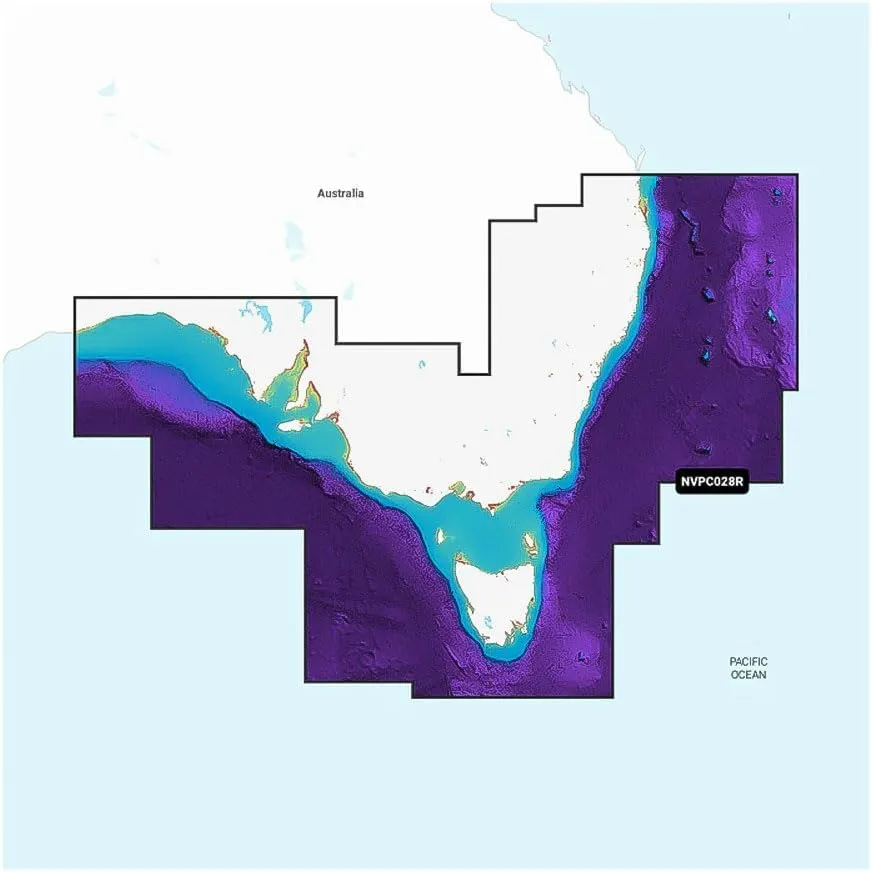
Garmin Navionics Vision Australia, Southeast - Inland and Coastal Marine Charts featuring vibrant colors, a streamlined interface and combined coastal/inland content with a popular navionics style color palette, Garmin Navionics cartography makes it easy to plot your course with the world’s no. 1 name in marine mapping. Access detail-rich mapping of coastal features, lakes, rivers and more. Integrated Garmin and navionics content offers coverage for boaters worldwide. Features, built-in Auto Guidance technology2 gives you a suggested dock-to-dock path to follow through channels, inlets, marina entrances and more.
 Mackie DRM18S-P 18\" 2000w Professional Passive Live Sound DJ PA Subwoofer Sub Bundle with (1) AKG P5i Handheld Dynamic Metal Vocal Microphone Mic (2 Items)")

")


,320m(348 Yds) Soft Smooth Yarn Sport Fine2 for Crocheting, Knitting, Amigurumi,Blankets,Garments 2 Skein 99944")

")

")
